Introduction
Earth Fire Alliance's FireSat project won the 2026 Gizmodo Science Fair for developing a satellite constellation dedicated to early wildfire detection. For years, researchers and firefighters have relied on multi-purpose satellites not originally designed to spot fires, often missing small ignitions until they've already grown. FireSat changes the paradigm by offering a dedicated network tuned specifically to detect the thermal signature of new fires from orbit, promising a crucial window for emergency response.
What Happened
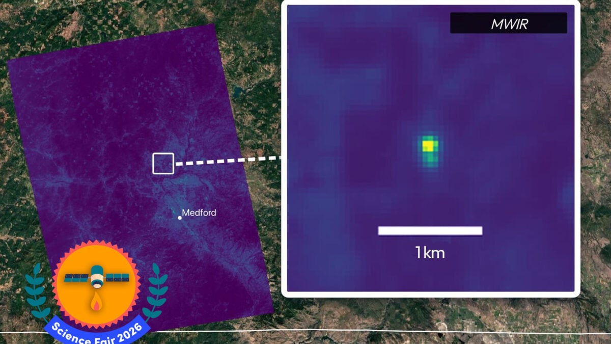
On July 7, the Earth Fire Alliance launched the first three operational satellites for the FireSat constellation, marking the start of a planned 50-satellite network in low-Earth orbit. The alliance, formed in 2024, treats FireSat as its flagship project aimed at confronting the escalating global wildfire crisis. Unlike general Earth-observation platforms, FireSat satellites carry advanced sensors that track both reflected sunlight and thermal emissions using a scanning mirror that directs energy into optical channels as the satellite sweeps across the planet's surface. The prototype mission, launched in March 2025, already demonstrated success by identifying a small roadside fire in Oregon caused by trailer chains on a highway—a fire that went undetected by other space-based systems.
Why This Matters
Current weather and Earth-observation satellites typically capture fire data only every 12 to 24 hours and at resolutions too coarse to spot small hotspots, limiting their usefulness for ground responders. FireSat delivers high-resolution imagery capable of identifying fires as small as 16 by 16 feet—roughly the size of a backyard swimming pool—every 20 minutes once the full constellation is operational. The system's six multispectral imaging bands provide detailed data on fire direction, vegetation moisture, surface temperature, and burn scar analysis. During testing, FireSat tracked the Big Grass Fire along the Oregon-Idaho border, which had already consumed nearly 290,000 acres at the time of detection, proving its ability to monitor large-scale events while also catching tiny ignitions early. The data helps fire agencies model fire behavior, assess fuel loads, and decide on evacuation or suppression strategies with far greater precision.
Key Takeaways
The first three FireSat satellites are currently in the commissioning phase, with data being delivered to early adopters including global fire agencies, modeling teams, and scientists. By next year, data access will expand, and the goal is to integrate FireSat feeds directly into active firefighting and emergency response workflows. A partnership with SpaceX aims to equip satellites with Starlink laser terminals for real-time data streaming, bypassing traditional ground relay delays. Beyond immediate firefighting benefits, the constellation will generate a global, continuous dataset on fire behavior, enabling long-term climate and ecological research into how fires start, spread, and interact with changing climate conditions.
Conclusion
Michael Falkowski, lead scientist on the project, emphasized that the data FireSat will produce promises to transform global fire science. By catching fires at ignition and providing near real-time analytics, the constellation promises to shift wildfire management from reactive to proactive. As the network grows to 50 satellites, the insights gathered could inform better land-use policies, improved climate resilience strategies, and more effective emergency response worldwide. The early results suggest that a dedicated space-based fire-watching system is not just possible—it's already delivering results.


Discussion
Join the conversation
Thoughtful reactions, questions, and follow-up ideas help shape the next story.