Introduction
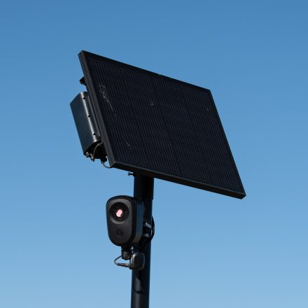
A new interactive map published this week has revealed the true scope of Flock Security's nationwide surveillance footprint, identifying more than 300,000 cameras and sensors operating across the United States. The map, built from Flock's own archived database, surpasses the company's claimed 120,000 devices and includes supplemental hardware such as acoustic detectors and third-party camera integrations.
What Happened
Joshua Michael, a cybersecurity researcher, discovered how to access Flock's internal device locations by exploiting a publicly available access token on Flock's servers. Using that token, he queried ArcGIS, the geographic information system Flock uses, and compiled a comprehensive map detailing every device's coordinates. The map was released Wednesday and cited during a Senate Subcommittee on Crime and Counterterrorism hearing. It color-codes each entry by model, distinguishing Flock's Falcon cameras from Picard processing units, and flags specific placements, including 860 devices near Chicago O'Hare, a camera inside the Silverdale Detention Center in Tennessee, and a device labeled FBI Pilot Camera at the J Edgar Hoover Building. The dataset also lists each device's assigned name and street address from Flock's records.
Why This Matters
The revelation comes as the American Civil Liberties Union released a report documenting a pattern of Flock misleading the public about its business practices, safety record, and privacy protections. Michael told The Intercept that Flock's repeated claims of never experiencing a data breach ring hollow after he exfiltrated the company's device database. The map's release also coincides with a trademark infringement complaint filed by an AI security firm against Michael's site, which he addressed with a disclaimer stating no affiliation with Flock. Privacy advocates argue that a network of this scale, capable of tracking where elected officials, federal agents, and military personnel travel, poses significant risks without transparent oversight.
Key Takeaways
- Over 300,000 Flock-related devices mapped nationwide, far exceeding the company's public 120,000-camera claim.
- Map relies on archived Flock database data, not user submissions, providing a more complete picture.
- Supplementary devices include 27,000 acoustic detection units and networking gear for third-party cameras.
- Specific placements reveal clustering near critical infrastructure, detention facilities, and government headquarters.
- Flock has denied wrongdoing and claimed no data breaches, but Michael's findings suggest otherwise.
- A trademark dispute and efforts to remove the map highlight the contentious nature of this surveillance network.
Conclusion
As lawmakers and civil rights groups weigh the implications of a pervasive, privately operated surveillance grid, the Flock map serves as a concrete reference point for public debate. Whether the technology is framed as a public-safety tool or a privacy infringement depends on transparency, accountability, and the extent to which communities are informed about the systems tracking their daily movements.



Discussion
Join the conversation
Thoughtful reactions, questions, and follow-up ideas help shape the next story.